Government
Critical Areas Ordinance Update
Tukwila is updating its critical area regulations to comply with state law, remain eligible for grant funding, and align with the City’s environmental goals and best available science.
The redlined draft of the updated Critical Areas Ordinance is now available for review.
View the redlined draft (PDF) →
Background
What are critical areas?
Critical areas include wetlands, streams, slopes, earthquake and coal mine hazard areas, and fish and wildlife habitat conservation areas. They provide habitat and essential ecosystem services — supporting cleaner air and water and more stable soils across Tukwila.
What is best available science (BAS)?
BAS is the most current science on the functions and values of critical areas, including how buffers protect wetlands, streams, and wildlife. State law (RCW 36.70a.175) requires its use when designating and protecting critical areas and preserving fisheries like salmon.
What are wetlands?
Wetlands are areas saturated by water long enough to support vegetation adapted to saturated soils — including bogs, swamps, marshes, ponds, and lakes. They improve water quality, manage stormwater and flooding, recharge groundwater, and support fish, wildlife, and recreation. Most artificially created wetlands are excluded unless created intentionally to mitigate wetland conversion.
What are streams?
Streams are natural or modified channels through which surface water flows, including the Green/Duwamish River. Like wetlands, they provide habitat, maintain water quality, manage flooding, and support recreation. Irrigation ditches and stormwater devices are excluded unless used by salmonids or conveying natural stream flows.
The Proposal
Tukwila is working with Facet, an environmental and engineering firm, through six steps:
- Best Available Science Review — Align regulations with current science
- Gap Analysis — Identify gaps in existing standards
- Public Engagement — Gather community input
- Draft Regulations — Release initial draft for informal feedback
- Comment Period — Formal public review
- Final Ordinance — City Council public hearing and vote
How could this affect my property?
Critical areas exist on or near many properties in Tukwila. Changes to buffer distances may affect what portions of a property can be developed. To check your property, use the City of Tukwila iMap viewer and enable the “Priority Habitats” and “Environmentally Critical Areas” layers. iMap doesn’t show all critical areas — contact the Permit Center to verify before any development.
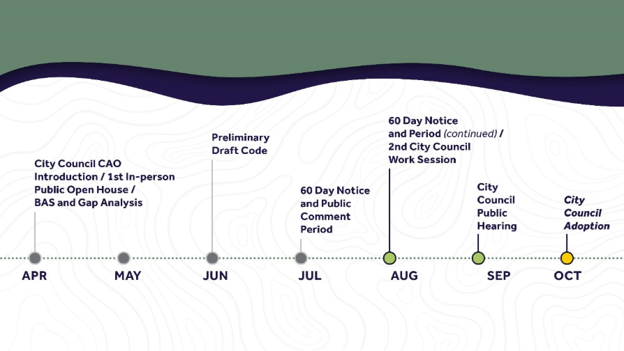
Timeline and Current Status
Scheduled Milestones:
- September 14th, 2026: The City Council’s Planning and Community Development Committee is scheduled to meet to discuss this topic and consider forwarding it to the Committee of the Whole.
- September 28th, 2026: The City Council’s Committee of the Whole is scheduled to meet to discuss this topic.
- October 5th, 2026: The City Council is scheduled to make a final decision regarding the proposal.
Engagement
How to get involved
- Draft regulations: Review the redlined draft (PDF)
- Email: planning@tukwilawa.gov — Subject: “Critical Area Update”
Stay informed
Sign up below to receive updates on the Critical Areas Ordinance update — including draft regulations, public comment opportunities, and hearing dates. When you fill out the form, select Critical Areas Ordinance Update/Tree Canopy to receive CAO-specific updates.