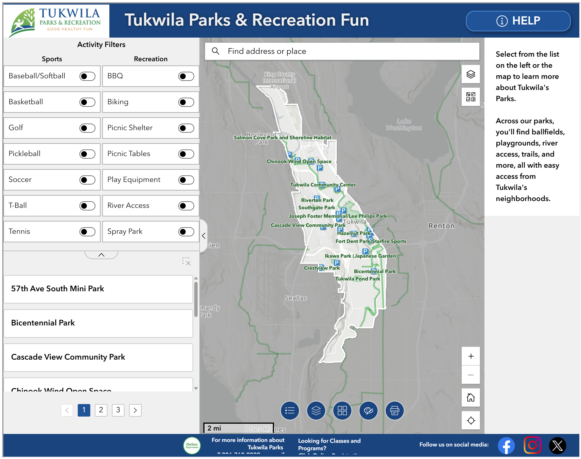
Government
City Maps
Tukwila iMap
An interactive map combining City of Tukwila GIS data with King County property information. View zoning, utilities, environmental data, and more.
Open Tukwila iMap →
GIS Open Data
Explore, view, and download geographic datasets including zoning, land use, environmental layers, transportation networks, and utilities.
View and download GIS data →
Development Viewer
An interactive map of active and recent development projects in Tukwila, including permit applications, land use decisions, and project status.
Open Development Viewer →
CIP and Construction Projects
View the Capital Improvement Program dashboard and current construction projects, including active work zones and transportation impacts across Tukwila.
View CIP and construction projects →
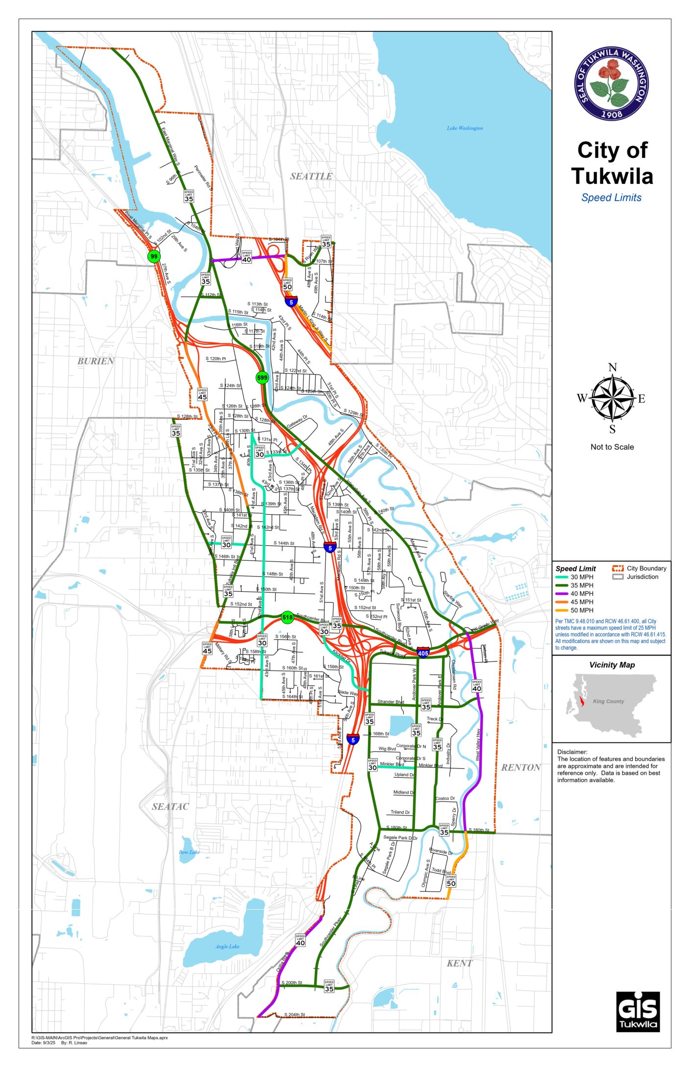
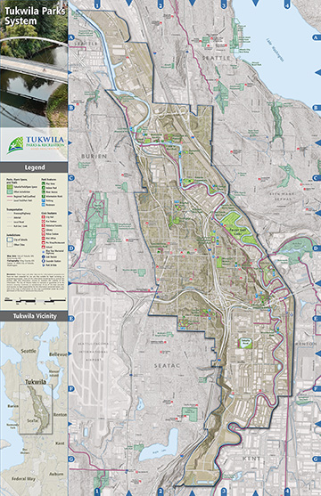
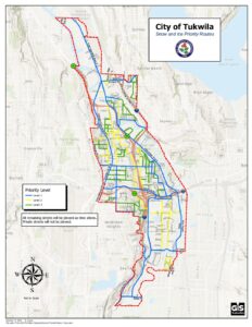
PDF maps

© 2026 City of Tukwila, WA
webmaster@tukwilawa.gov |
Terms of Use / Privacy